戻る<1|2|3|4|5|6|7|8|9|10|11|12|13|14|15<
|
配付プリント等 |
補足説明 |
|
|
Alfred Lothar Wegener (1880-1930), the originator of the theory of continental drift. (Photograph courtesy of the Alfred Wegener Institute for Polar and Marine Research, Bremerhaven, Germany.) |
〔W. Jacquelyne Kious and Robert I. TillingによるThis Dynamic Earth: the Story of Plate Tectonicsから〕 |
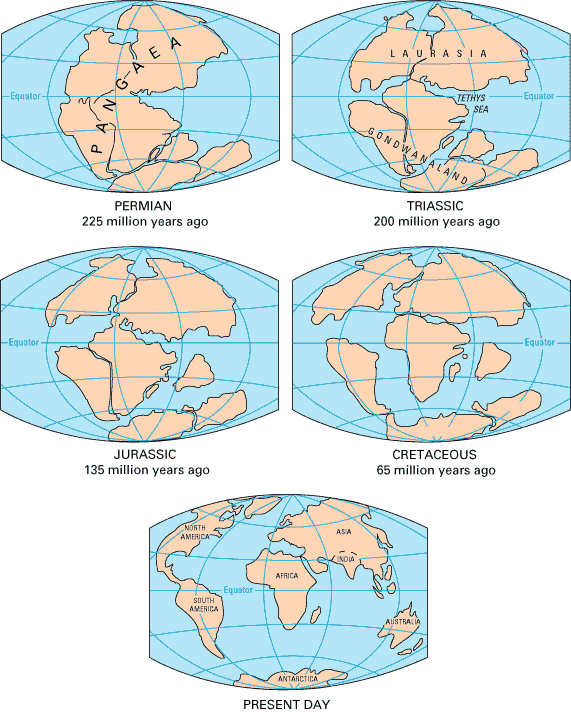
According to the continental drift theory, the supercontinent Pangaea began to break up about 225-200 million years ago, eventually fragmenting into the continents as we know them today. 〔W. Jacquelyne Kious and Robert I. TillingによるThis Dynamic Earth: the Story of Plate Tectonicsから〕 大陸移動説によれば、超大陸パンゲアは約2億年前に分裂を始めた。 |
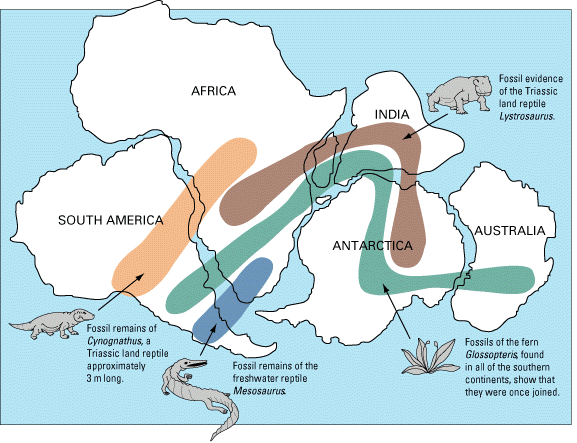
As noted by Snider-Pellegrini and Wegener, the locations of certain fossil plants and animals on present-day, widely separated continents would form definite patterns (shown by the bands of colors), if the continents are rejoined. 〔W. Jacquelyne Kious and Robert I. TillingによるThis Dynamic Earth: the Story of Plate Tectonicsから〕 現在見られる動植物の化石の分布は、当時大陸が合体していたと考えると説明できる。 |
参考 |
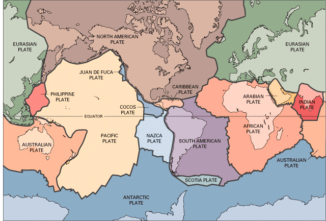
〔W. Jacquelyne Kious and Robert I. TillingによるThis Dynamic Earth: the Story of Plate Tectonicsから〕 主要なプレート。十数枚ある。 |
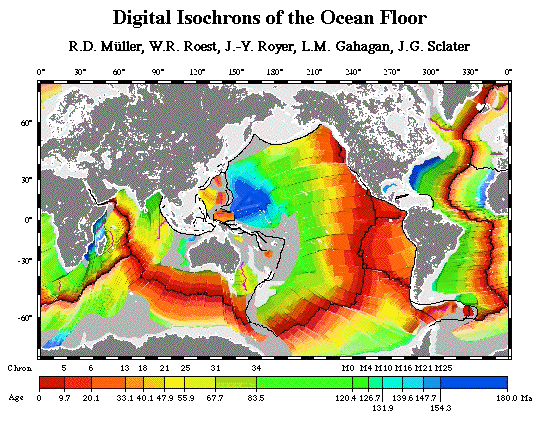
〔John C. Lahr氏によるHow to Build a Model Illustrating Sea-Floor Spreading and Subductionから〕 海底の年齢(放射年代による)。現在は濃い赤色で示され、古い時代は青色で示される。海嶺に近いほど若く、離れるにつれて古くなり、例えば日本列島の南東側では1億5000万年より古い時代の海底が存在する。海嶺で海洋地殻が誕生し、沈み込み帯(海溝)でマントルへ沈み込んで地表から消えていくことを示している。 |
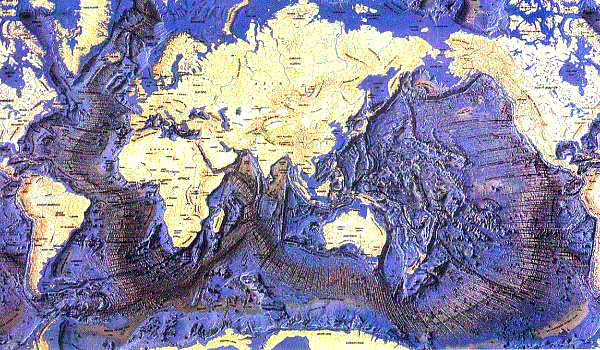
A three-dimensional map of the oceans(海底地形) 〔Seafriends Marine Conservation and Education Centreによるseafriendsの『oceanography』の中の『Oceanography: Oceans』から〕 海底の地形。海洋地殻が誕生する場である海嶺は、海底活火山脈である。主に太平洋の周囲にある海溝は、海洋地殻がマントルへ沈み込む場である。これらを含むプレート境界部で地震が多発する。 |