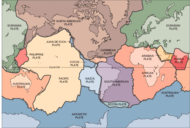
 〔W. Jacquelyne Kious and Robert I. TillingによるThis Dynamic Earth: the Story of Plate Tectonicsから〕 大きなプレートは十数枚。 |
戻る<1|2|3|4|5|6|7|8|9|10|11|12|13|14|15<
|
|
| 配付プリント等 |
| 補足説明 |
|
|
 〔W. Jacquelyne Kious and Robert I. TillingによるThis Dynamic Earth: the Story of Plate Tectonicsから〕 大きなプレートは十数枚。 |
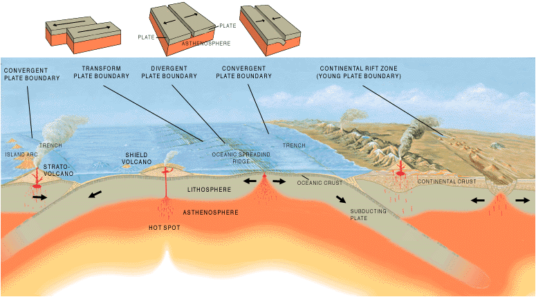 A cross section illustrating the main types of plate boundaries. Illustration by Jose F. Vigil from This Dynamic Planet -- a wall map produced jointly by the U.S. Geological Survey, the Smithsonian Institution, and the U.S. Naval Research Laboratory. 〔USGSのIndex of pubs.usgs.gov/gip/の『Earthquakes』の『Where Earthquakes Occur』から〕 プレート境界は、1)発散(divergent)、2)収束(convergent)、3)すれ違い(transform;トランスフォーム断層)の3つ。発散が起こっている場所の例は海嶺(ridge)とリフト(rift)、収束の例は海溝(trench)〔あるいはもっと広く沈み込み帯(subducting zone)〕。ホットスポットは、マントルの深い部分からプレートを貫いてプルームが上昇する場所(例えば、ハワイ島)。 |
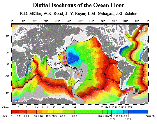 〔John C. Lahr氏によるHow to Build a Model Illustrating Sea-Floor Spreading and Subductionから〕 海洋底の生成年代。時代が若い海底は海嶺側に分布する。海洋地殻は海嶺で誕生し、海溝(沈み込み帯)でマントルへ沈み込んでいく、ことで説明される。 |
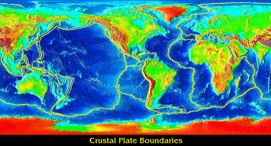 〔Rosanna L. Hamilton氏によるEarth's Interior & Plate Tectonicsから〕 黄色線はプレート境界を示す。 |
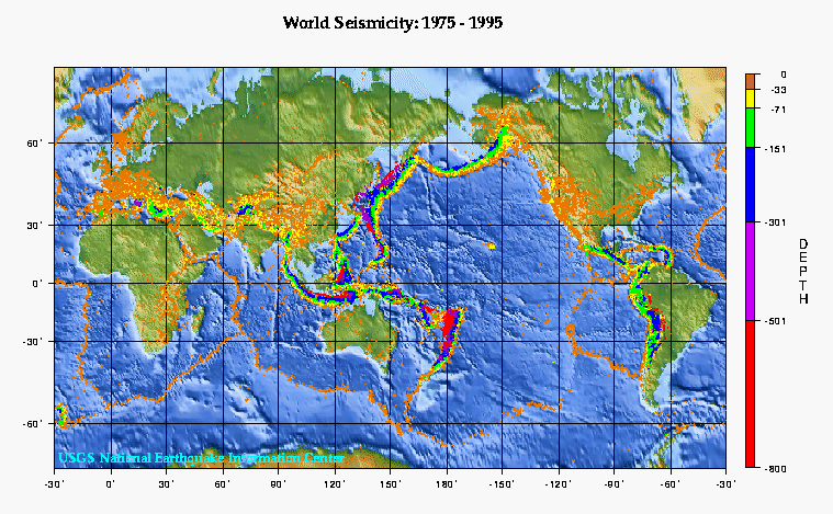 〔USGSによるEarthquake Hazards Programの中の『Earthquake Activity』から〕 震源分布。 |
| 参考 |