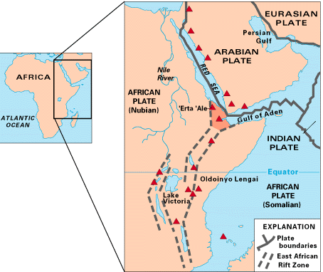
■アイスランド/ジブチ/大地溝帯/
■プレートテクトニクス/海嶺/
■アルビン号/
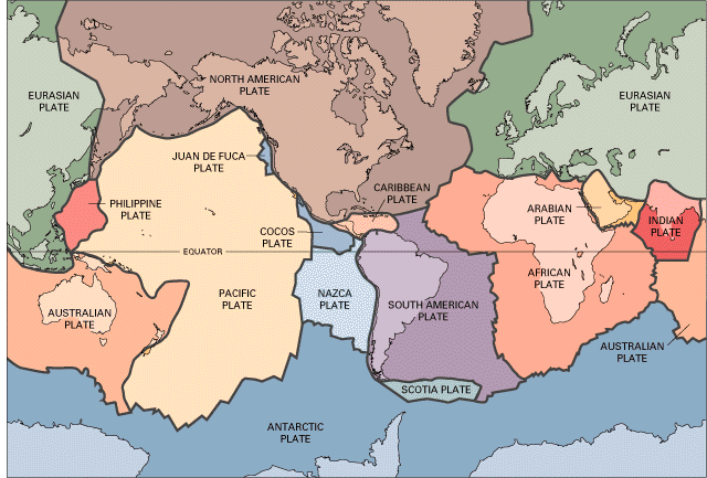 〔W. Jacquelyne Kious and Robert I. TillingによるThis Dynamic Earth: the Story of Plate Tectonicsから〕 大きなプレートは十数枚。 |
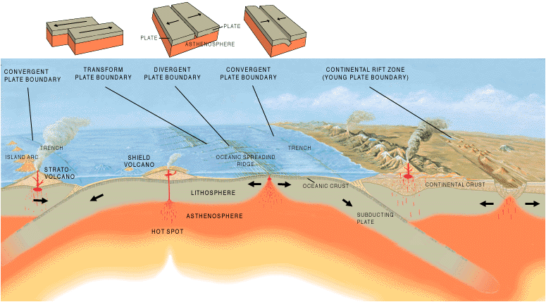 A cross section illustrating the main types of plate boundaries. Illustration by Jose F. Vigil from This Dynamic Planet -- a wall map produced jointly by the U.S. Geological Survey, the Smithsonian Institution, and the U.S. Naval Research Laboratory. 〔USGSのIndex of pubs.usgs.gov/gip/の『Earthquakes』の『Where Earthquakes Occur』から〕 プレート境界は、1)発散(divergent)、2)収束(convergent)、3)すれ違い(transform;トランスフォーム断層)の3つ。発散が起こっている場所の例は海嶺(ridge)とリフト(rift)、収束の例は海溝(trench)〔あるいはもっと広く沈み込み帯(subducting zone)〕。ホットスポットは、マントルの深い部分からプレートを貫いてプルームが上昇する場所(例えば、ハワイ島)。 |
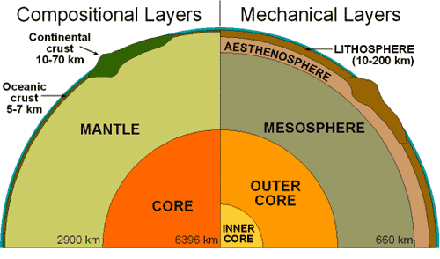
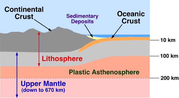 Figure 10h-2: Structure of the Earth's crust and top most layer of the upper mantle. The lithosphere consists of the oceanic crust, continental crust, and uppermost mantle. Beneath the lithosphere is the asthenosphere. This layer, which is also part of the upper mantle, extends to a depth of about 200 kilometers. Sedimentary deposits are commonly found at the boundaries between the continental and oceanic crust. 〔Michael Pidwirny氏によるPhysicalGeography.netの『FUNDAMENTALS OF PHYSICAL GEOGRAPHY』の『CHAPTER 10: Introduction to the Lithosphere』の中の『(h). Structure of the Earth』から〕 地殻(海洋地殻と大陸地殻)+マントル最上部=リソスフェア(プレート)。プレートの厚さは100~150kmで、剛板(硬い板)のように振舞う。アセノスフェアは軟らかく(温度が高く、一部溶融しているらしい)、その上をプレートが滑るように水平移動する。 |
|
How Thick Is the Earth's Crust? 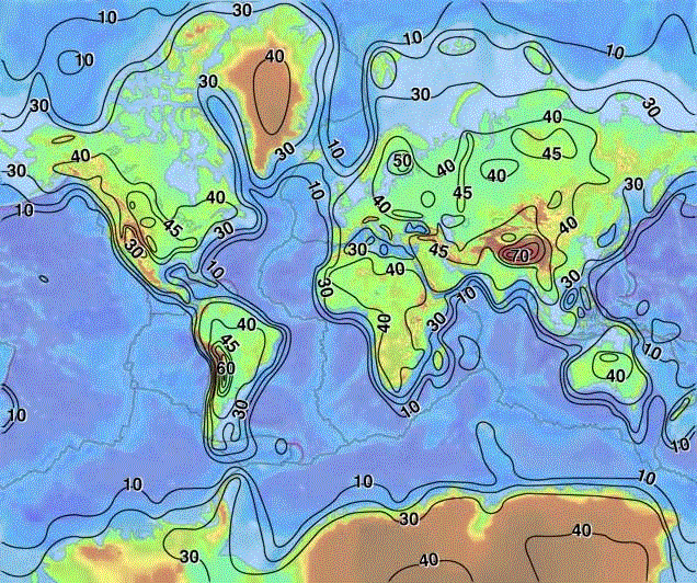 〔USGSによるEarthquake Hazardsの中の『The Earth's Crust』から〕 大陸地殻の厚さは30~40kmだが、70kmを越すところもある。一方、海洋地殻は10km以下。 |
