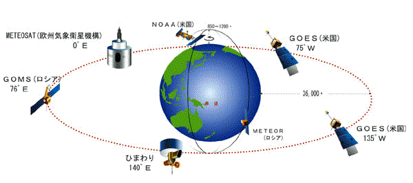
 〔気象庁の気象衛星センターの『「ひまわり」を中心とした気象衛星の観測システム』の『全地球規模で気象観測』から〕 |
 |
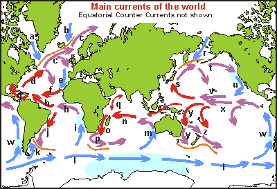
a Labrador Current b East Greenland C. c North Atlantic Drift d Gulf Stream e Canary C. f North Equatorial C. g Caribbean C. h South Equatorial C. i Benguela C. j Brazil C. k Falkland C. l West Wind Drift m West Australian C. |
n South Equatorial C. o Mozambique C. p Agulhas C. q Monsoon Drift r Kamchatka C./Oya Shio s Kuro Shio C. t North Pacific Drift u California C. v North Equatorial C. w Peru/ Humboldt C. x South Equatorial C. y East Australia C. z East Auckland C. |
|
〔Seafriends Marine Conservation and Education Centreによるseafriendsの『oceanography』の中の『Oceanography - currents』から〕 主な海流。 |
||
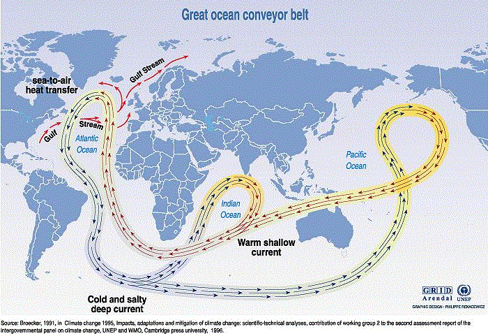
 〔UNEPの『Maps & Graphics』の『Vital Climate Graphics』の『Potential impacts of climate change』から〕 ブロッカーによる海洋ベルトコンベアモデル。 |
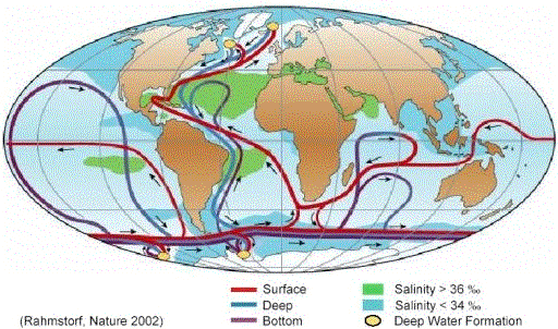
 Figure 1. Schematic representation of the global thermohaline
circulation(熱塩循環). 〔Potsdam Institute for Climate Impact ResearchのStefan Rahmstorf氏による『The Thermohaline Ocean Circulation A Brief Fact Sheet』から〕 ブロッカーのモデルの改訂版。 |